
We propose to map rural heat islands and to co-produce knowledge on heat stress exposure and dissemination strategies with the farmworker community of Imperial Valley, California, including six major Research Activities:
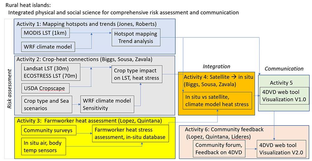
Figure 1. Schematic diagram of the six Research Activities and their interconnections.
Our methods and results for the Imperial Valley will have implications for other areas in California experiencing water scarcity and cropping changes, such as the Central Valley. Our methodology, results, and communication strategy will provide guidance on how best to engage vulnerable populations in co-production of knowledge on climate information, perceptions, and experiences of heat stress under rapidly changing environmental conditions. Our project includes significant involvement of both community advocates (Lideres Campesinas) and will also help develop computing capacity and expertise at the growing SDSU-Imperial Valley campus.
The Imperial Valley is one of the most important agricultural areas in California, especially for winter vegetable production and fodder crops. Irrigation of the 500,000 cultivated acres (Imperial County Farm Bureau, 2023) is supplied by the Colorado River. The Quantification Settlement Agreement (QSA) requires the Imperial Irrigation District to reduce water withdrawals by a maximum 300,000 acre-feet, using a combination of fallowing and water conservation methods. Some conservation methods result in decreased return flow to the Salton Sea, resulting in rapid decrease in the area of the Sea (Cohen et al, 2014).
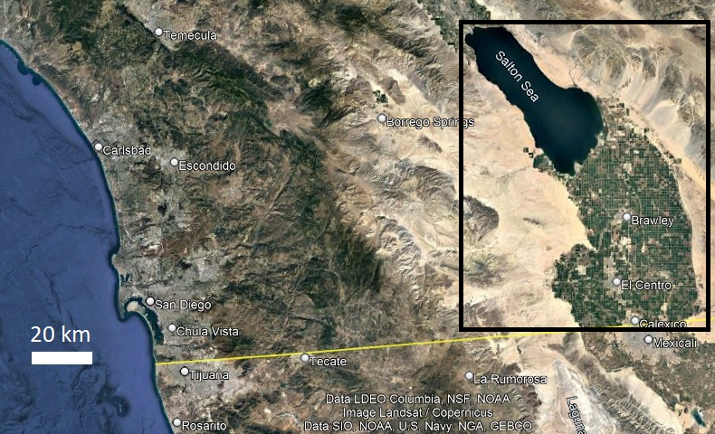
Figure 2. Location map of the Imperial Valley and Salton Sea (black box), California.
Copyright © 2025 - All Rights Reserved | Document Reader